Oil & Gas Pipeline Survey
Survey 5
River and Lake Scan technology of pipeline crossings survey
Scan4Pipes Boat, equipped with RTK/GPS, sonar & EML systems, run from the riverside
Survey process — passage of the boat along the pipeline route on both sides and then crossed tacks with a cruise speed between 1-5 m/s
Underwater camera & lighting system uses for effective visual inspection of pipeline and river bottom
Obtained data transmitting by telemetry to the Control Unit on the riverside in real time mode and simultaneously recording on PC Upon completion of the survey boat returns to the place of deployment on the riverside by command from Autopilot
Interpretation and analysis of obtaining data for assessment of pipeline technical integrity, operation reliability and environmental safety

Technical survey of pipeline river crossings
Remote controlled Scan4Pipes survey boat
Wireless data transmission up to 5000 m
Max speed up to 5m/sec
Endurance up to 7 h
RTK/GPS Satellite positioning system
Echo sound system HydroBox & Tritech
Side scan sonar Tritech SF 990 F
Underwater colour camera & lighting system incl. LYYN
Options:
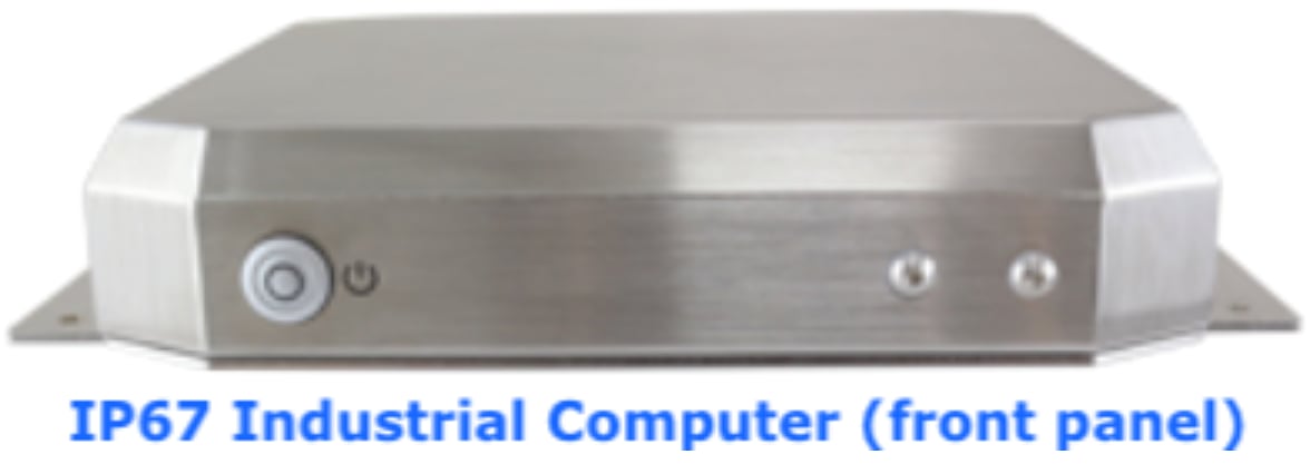
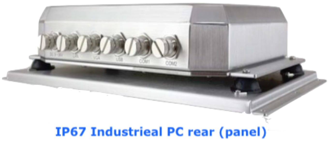
IP67 Industrial PC (rear panel)
Parametric Sub-Bottom Profiler Tritech SK
Round scan sonar Tritech SP
ADCP Rio Grande Teledyne RD
Electromagnetic Pipe Locator
Sampling Water equipment
On-board computer rugged IP67
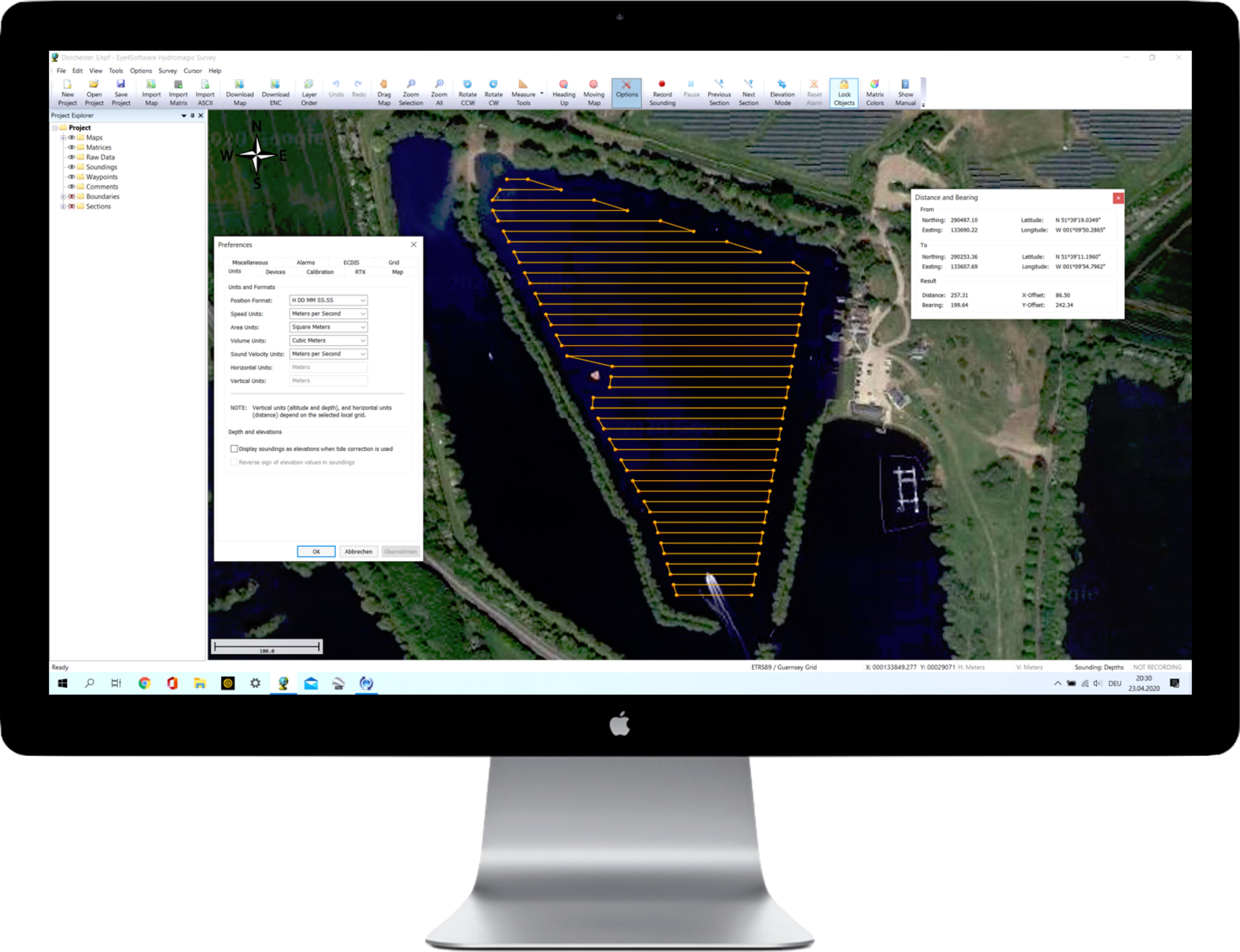
Software SonarWiz, NaviPac & NaviScan, AquaScan, PipeTracer and Hydromagic
Scan4Pipes Europe GmbH
Umgehungsstraße 78b - Hauptgebäude
D-99441 Mellingen
Germany
E-Mail: office@scan4pipes.com
Phone: +49 176 346 928 81
Website: scan4pipes.com
© Scan4Pipes Europe GmbH 2019 - 2023
Steuernummer: 162/118/05297
USt.-IdNr.: DE328138499
Registergericht: Jena
Handelsregister: HRB 516297